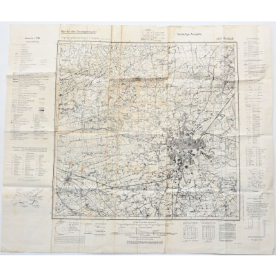
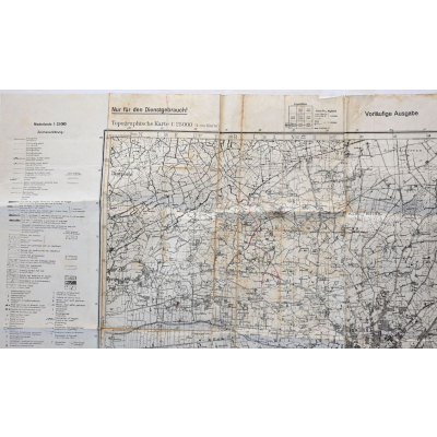
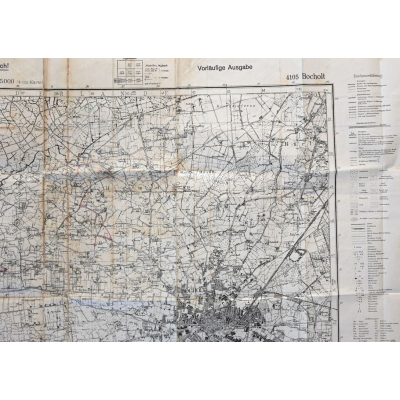
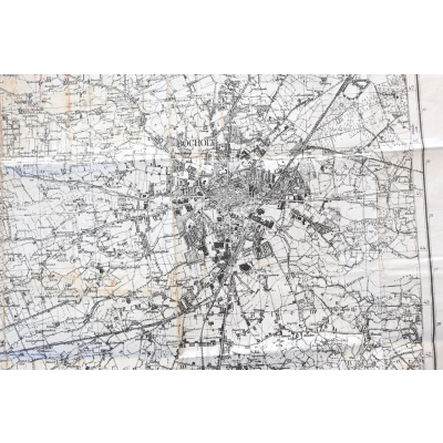
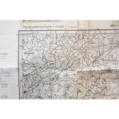

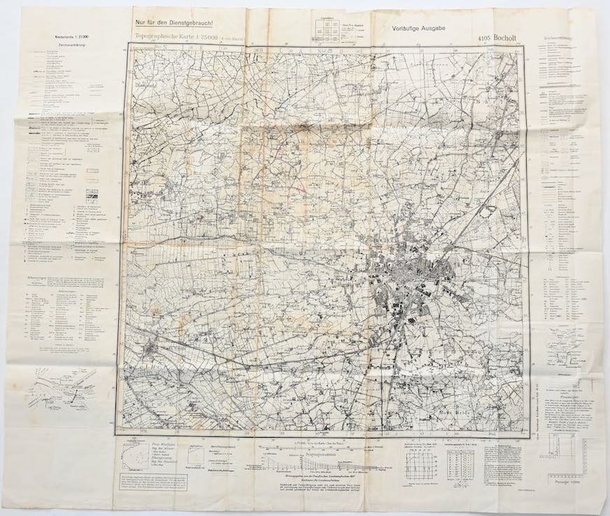
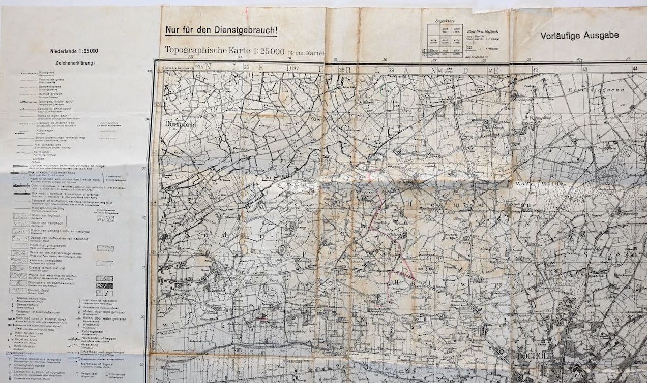
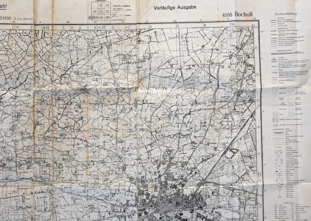
Deutsche Heereskarte of Bocholt 1945
SOLD
Nice Wehrmacht issued map in used, but good condition of the German area of Bocholt.
Availability:Out of stock
Product Number
20450
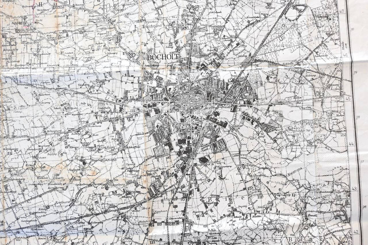
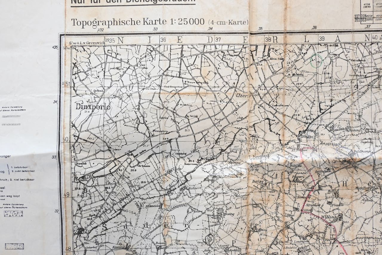
The map shows overall signs of use. It has 2 small damages (mainly on the edges), but overall it's in solid condition. The map shows a section of the Dutch/Germany border of Bocholt/Dinxperlo .
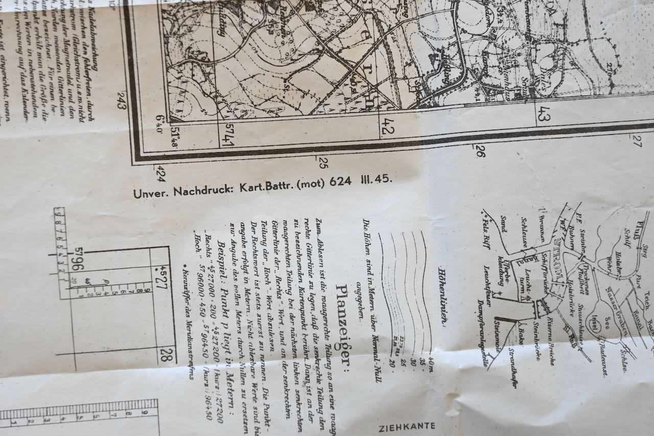
The map was printed by the Karten Batterie (mot) 624 in March 1945.
The size of the map is approx. 68cm*58cm
| Product Number | 20450 |
|---|---|
| Weight | 0.035000 |
| branch | Heer |
| Unit: | Piece |
We found other products you might like!
 Out of Stock
  Out of Stock
  Out of Stock
 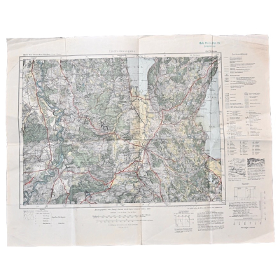 Out of Stock
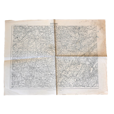
 Out of Stock
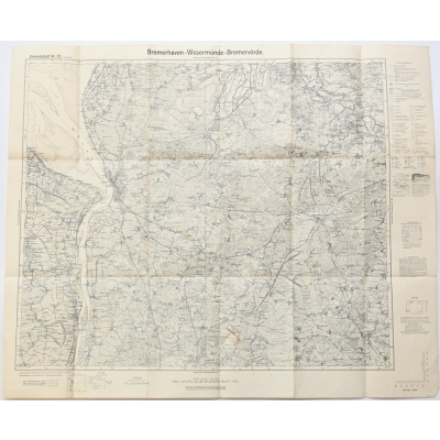

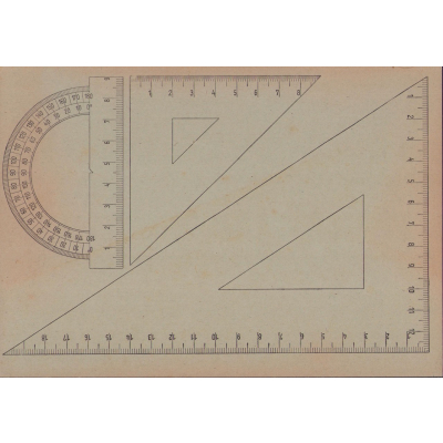
Wehrmacht Map Case Ruler
€22.50
 Out of Stock
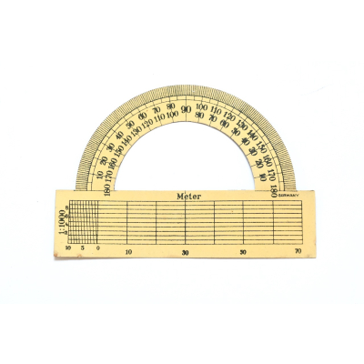
Wehrmacht Map Case Ruler
€35.00

2./L.Art.E.Abt.17 EKM
€45.00
 Out of Stock
  Out of Stock
  Out of Stock